
Apollo Beach Flood Zones by Neighborhood, and How to Check Any Tampa Bay Home
By Shawna Calvert, The Calvert Home Team at 27North Realty. Last reviewed October 30, 2026.
Parts of it. Almost everything west of US Highway 41, toward the water, is in a flood zone, and most of Apollo Beach east of 41 is in Zone X, outside it. Homes built after about 2000 sit near 10 feet of elevation and usually insure for much less than the original neighborhoods built at 1 to 6 feet.
I love this question, because the honest answer isn’t as straightforward as people want it to be, but there’s a rule of thumb that gets you most of the way there.
Which Apollo Beach neighborhoods are in a flood zone?
I wanted you to be able to see the whole picture at once, so we checked every home in fourteen Apollo Beach neighborhoods against FEMA’s current flood map. Not a handful of listings, every one of them: 10,484 homes from the Hillsborough County Property Appraiser’s parcel records, each matched to FEMA’s National Flood Hazard Layer in October 2026. They are sorted from the most homes in the high-risk zone to the fewest.
| Neighborhood | Homes checked | High risk (AE or VE) | Moderate (shaded X) | Minimal (unshaded X) | Base flood elevation |
|---|---|---|---|---|---|
| Symphony Isles | 287 | 100% | 0% | 0% | 10 to 11 ft |
| Sabal Key | 134 | 100% | 0% | 0% | 11 ft |
| Caribbean Isles | 519 | 100% | 0% | 0% | 11 ft |
| Treviso | 26 | 100% | 0% | 0% | 11 ft |
| Original Apollo Beach (the Apollo Beach Unit plats) | 1,903 | 99% | 1% | 0% | 10 to 12 ft |
| Andalucía | 91 | 99% (1 home in VE) | 1% | 0% | 11 ft |
| Marisol Pointe | 108 | 93% | 2% | 6% | 10 to 11 ft |
| Bimini Bay | 156 | 90% | 10% | 0% | 10 to 11 ft |
| Hemingway Estates | 39 | 87% | 13% | 0% | 11 ft |
| MiraBay | 1,362 | 85% | 15% | 0% | 10 to 11 ft |
| Harbour Isles | 494 | 37% | 63% | 0% | 9 to 10 ft |
| Southshore Falls (Del Webb) | 868 | 25% | 75% | 0% | 10 ft |
| Waterset | 3,079 | Under 1% (1 home) | 2% | 97% | 10 ft (1 home) |
| Covington Park | 1,418 | 0% | 0% | 100% | None mapped |
What jumps out at me is how closely this lines up with the rule I give everyone. The canal and bay communities west of 41 are almost entirely in the high-risk AE zone, while Waterset and Covington Park are almost entirely out of it. The ones in the middle are worth a closer look. Most homes in Harbour Isles and Southshore Falls are in shaded X, but a quarter to a third of them are in AE, so two homes a street apart can get very different insurance answers there.
Now look at the last column. Across Apollo Beach, the base flood elevation is mostly 10 to 11 feet. That is the height FEMA expects floodwater to reach in a flood with a 1% chance of happening in any given year, and it is exactly why the communities built up around 10 feet after 2000 insure so differently from the original neighborhoods built at 1 to 6 feet. Same zone letter, very different house.
How we built this table: we counted every residential parcel with a home on it, grouped by the subdivision names on the recorded plats, so MiraBay includes all of its phases and Waterset includes all of its plats. Each home is placed at the center of its lot and matched to the FEMA map, using Hillsborough County flood maps effective October 7, 2021. A lot that straddles two zones is counted where its center sits, and FEMA does revise its maps, so always confirm the exact address before you rely on it. Source: FEMA National Flood Hazard Layer and Hillsborough County Property Appraiser parcel data, checked October 30, 2026.
How can you tell if an Apollo Beach home is in a flood zone?
Stand on Highway 41 and look west, toward the water. Almost everything on that side is in a flood zone. Look east, and you’re generally out of one.
There are exceptions. A couple of streets and a few communities east of 41 that are still in the AE flood zone. The rest over there are in Zone X. But west of 41, plan on flood insurance. You can count on it.
Is being in a flood zone a bad thing?
There are levels to what that actually looks like, and the level comes down to one number: elevation.
Why does elevation decide your flood insurance premium?
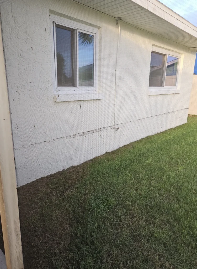
Apollo Beach was originally built where it landed, at 1, 2, 4 or 6 feet above sea level. As time went on, that changed. The communities built from about 2000 on were raised to about 10 feet. So any community you see built after 2000, you can pretty much take to the bank that those homes sit at 10 feet.
Ten feet above sea level insures very differently than one foot above sea level. There are other factors, like impact-rated windows and doors, the age of the home and other components, but elevation is the big one. In a flood zone at 10 feet and above, you can usually find flood insurance that’s very reasonable.
Why do the years 2000 and 2002 matter?
Since the 2002 Florida Building Code, new coastal homes have had to include either impact-rated windows and doors, or approved shutters you put up when a storm is coming. One or the other. Impact windows and doors are typically on higher-end homes, or homes somebody retrofitted after they moved in. Either way, it brings your premium down.
What do AE, VE and X mean?
| Zone | What it tells you |
|---|---|
| AE | A high-risk Special Flood Hazard Area with a mapped base flood elevation. In Apollo Beach, this is most of the waterfront west of US 41. The home’s elevation compared to that base flood elevation drives the premium. |
| VE | A high-risk coastal zone with added wave hazard, also with a mapped base flood elevation. Building requirements are stricter here. |
| X (shaded) | Moderate flood hazard. Lower mapped risk than an A or V zone, but not no risk. |
| X (unshaded) | Minimal mapped flood hazard. Flooding can still happen anywhere it rains. |
Most of Apollo Beach east of 41 is mapped Zone X. And being in a flood zone is not a bad thing. There are levels to it, and elevation decides which level you are living at. The phrase “100-year flood” does not mean a flood comes once a century, either. It means a 1% annual chance of a flood event of that magnitude; another flood can happen the very next year. FloodSmart has a plain explanation of each flood zone.
Did Hurricane Helene flood Apollo Beach?
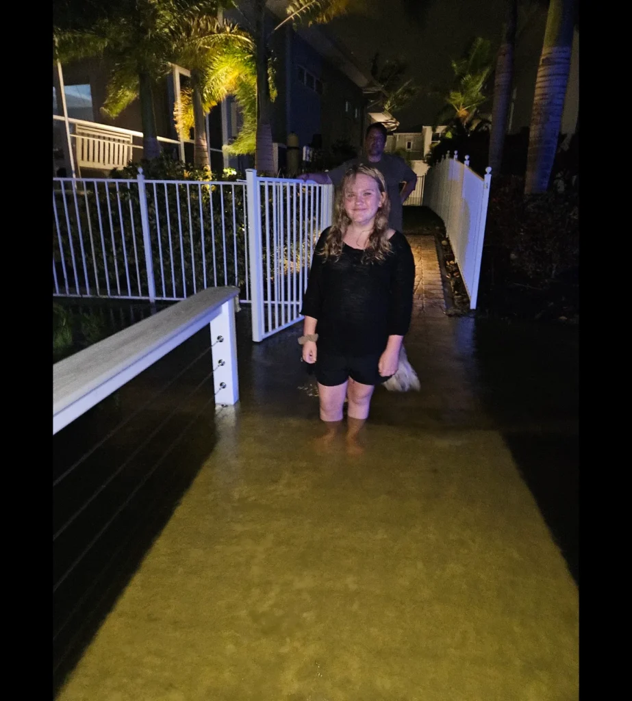
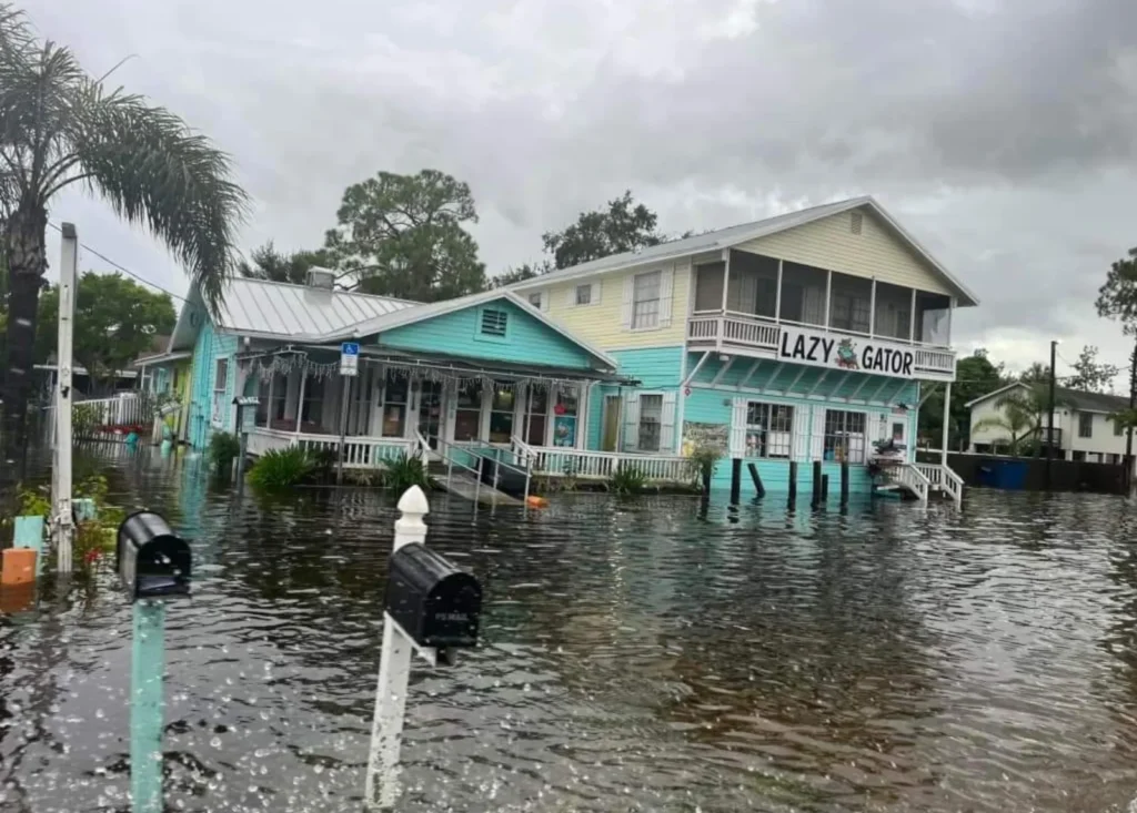
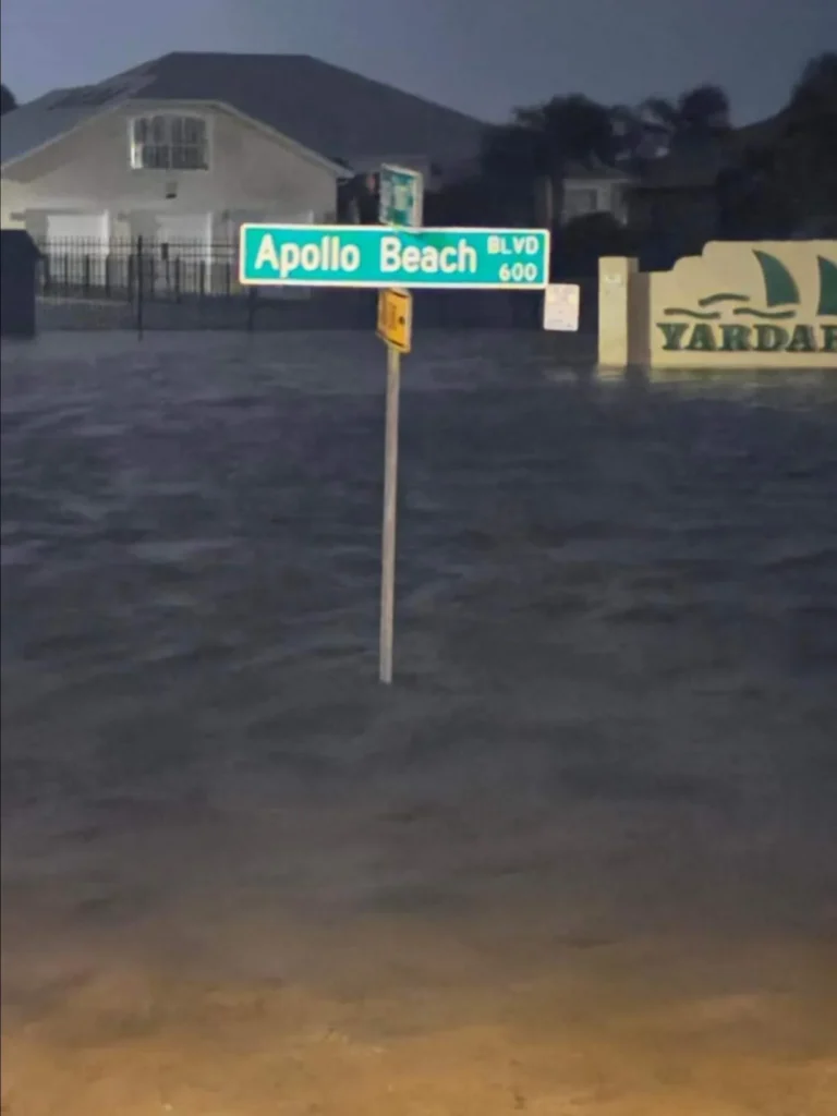
Helene is the one storm in our written history that hit like that. The surge came in at 4 to 6 feet max, really about 4, so it hit the older, original, low-lying parts of Apollo Beach devastatingly hard. The newer communities up at 10 feet weren’t impacted. It doesn’t even feel like you’re driving uphill, but you’re going up six feet, and six feet was the whole difference.
In my local experience, many neighborhoods built after roughly 2000 were built around ten feet in elevation and performed differently from older homes around zero to six feet. That is my rule of thumb, not a verified universal code change; a construction year does not establish a particular home’s elevation. During Hurricane Helene in 2024, I observed water intrusion in lower waterfront portions of Little Harbor, Ruskin and Apollo Beach. In my experience, Helene brought the water and Milton brought the wind. Impacts varied sharply, even within one community. Some older Little Harbor condos had approximately 3–4 inches in garages; some nearby lower residential areas had approximately 3–4 feet inside homes. Those are separate observations, not a single flood depth or a measurement of regional storm surge. I observed higher, newer areas, including Antigua Cove and newer condo sections, avoiding that intrusion; I did not survey every building, and past performance is no guarantee.
Maps are a starting point. If you love the view, investigate the actual home’s elevation, flood history, building configuration and insurance options. Ask your insurer to distinguish flood coverage from wind coverage and quote the home’s actual features; a higher elevation does not eliminate flood risk.
How do you evacuate from Apollo Beach in a hurricane?
Highway 41 is your evacuation route. So the closer you are to 41, the shorter your run to it. The farther west you go, the farther you have to travel to get there.
And worth saying plainly: hurricanes don’t pop up overnight. We know about them a week out, usually two. They’re on the news and we’re watching them and planning for them long before anything happens.
Here’s the part most people don’t think about: sometimes you have to drive through those older, lower neighborhoods to get to the newer ones. If we ever had another hundred-year storm and you’re sitting high and dry while everything around you has water in it, do you want to sit there until it recedes? Maybe, maybe not. Think about your route, not just your lot.
Is a flood zone the same as an evacuation zone?
No, and you need to check both. FEMA flood zones describe mapped flood hazard and drive insurance and building rules. Evacuation zones are how the county decides who has to leave when a hurricane is coming, based on storm surge. Hillsborough uses zones A through E for evacuation, and those letters have nothing to do with flood zone letters. A home in flood zone X can still sit in an evacuation zone.
The county updated its evacuation zones in 2026, so use the current evacuation address lookup rather than a map someone saved a few years ago. The county also explains evacuation zones versus flood zones, and I covered what changed in Apollo Beach.
Which parts of Tampa Bay are in a flood zone?
Mostly the low ground near the water. Homes along Tampa Bay, on the Gulf beaches like Treasure Island and St. Pete Beach, along the Intracoastal, and on the rivers and canals that feed them are the ones most often mapped in the high-risk A and V zones, while higher ground inland is more often Zone X. Each county maps it a little differently and the zone can change from one street to the next, so it has to be checked address by address. In Apollo Beach, the US 41 rule and the neighborhood table at the top of this page get you most of the way there.
A general rule gets you oriented. It does not replace checking the exact address, because the mapped zone can change from street to street and sometimes from lot to lot.
How do you check the flood zone for a specific address?
In Hillsborough County, start with the county’s Find My Flood Zone page and open its FEMA Effective Flood Zone Viewer. Search the address and look at where the house itself sits, not just the parcel, because one lot can cross more than one mapped zone. Save what you find, then have your lender or insurance agent confirm how it applies to the building you are buying.
FEMA’s Flood Map Service Center is the second place to look, for the effective maps and any map changes. In Pinellas, Pasco, Manatee or any other county, use that county’s own flood zone lookup or go straight to FEMA, which covers every address in the country. The county also has its own floodplain viewer. The county map and the FEMA insurance map serve related but different purposes, so do not swap one for the other when you are working out whether flood insurance is required.
Look the address up on FEMA’s Flood Map Service Center at msc.fema.gov, which shows the official flood zone for any address. Then ask for the home’s elevation certificate, because elevation, not just the zone, is what sets your premium. Or send me the street and I will check its flood zone and elevation for you myself on my flood zone and elevation check page.
Will your lender require flood insurance?
If the home is in a Special Flood Hazard Area and you have a federally backed mortgage, yes, flood insurance is required, and your lender makes the final call for your property and loan. Lenders can require it in other cases too. And do not wait for a storm to shop for it. Once a named storm is headed our way, insurers stop issuing new flood policies, so you cannot buy one at that point. Get it in place well before hurricane season gets busy.
Do I need flood insurance if the home is not in a flood zone?
It is often still worth having, and it usually costs less outside the higher risk zones. Standard homeowners policies do not cover flood. If your wind coverage is with Citizens, flood coverage will be required on nearly all policies by January 1, 2027, even outside a flood zone. Flood insurance costs are specific to each property, so get a quote from your own insurance agent before you finalize an offer.
If you are paying cash, it is not required, and it becomes a math question. Compare what the premiums add up to over ten years with what the policy would actually cover. A flood policy pays for water intrusion, not wind. For a minor intrusion, years of saved premium go a long way toward new floors. In a catastrophic flood, the standard policy caps building coverage at $250,000, which will not rebuild most homes here. It is a lot to weigh, and I am happy to talk it through with you and your insurance agent.
Some flood policies can be transferred or assumed and others cannot. Have the insurer confirm eligibility, terms and the buyer’s actual premium rather than relying on the seller’s current payment. More on that in my flood insurance guide.
Does an elevation certificate tell you what insurance will cost?
Not by itself. An elevation certificate records the building’s elevation and details, which helps your agent quote it, but it is not a price. NFIP guidance says most homeowners do not need one to buy coverage, although a certificate can help find a better rate and may be needed for local compliance in high-risk areas. Ask for any certificate the seller has and give it to your insurance agent. NFIP elevation certificate guidance
What should you ask for before you make an offer?
Ask for the seller’s flood disclosure, any flood claims or insurance payouts, the elevation certificate if there is one, and records of any flood-related repairs. Ask whether water has ever come into the living area, the garage or a lower enclosure, and how it was fixed. Then get your own written insurance quote, because the seller’s premium may not be the price available to you. Compare building and contents coverage, deductibles and the effective date.
Ask whether flood insurance will be required and what the seller pays now. Ask how old the home is, whether it has an elevation certificate, and whether it has impact windows or approved shutters, since either one can lower your premium. Ask about past flood claims or storm damage, which Florida sellers must disclose in writing since October 1, 2025. And drive the route out to US 41, because some neighborhoods west of 41 travel lower lying roads before they reach it.
During your inspection period, have your inspector look at drainage, where the mechanical equipment sits, and anything built in below an elevated floor. My waterfront home checklist puts all of this on one page.
How does Apollo Beach compare to the rest of Tampa Bay?
Below 10 feet doesn’t mean unaffordable. Apollo Beach is still very economical elevation-wise compared to Davis Islands or parts of St. Pete, which sit at those same 1-to-10-foot elevations. We’ve simply had far fewer flood and hurricane impacts here.
What should you look for when shopping for a home in Apollo Beach?
Stay closer to the highway if you can. MiraBay, Harbour Isles, Mangrove Manor, Mangrove Point, Waterset and Braemar are all built up around 10 feet with an easy, direct run to 41. Look at communities built after the year 2000. They’re built up at 10 feet, so you’re starting from a much better place, and you should still read the seller’s disclosure. Find out the elevation, find out whether it’s impact windows or shutters, and get a real flood quote on that specific address before you fall in love with it.
That last part is what I do for people. I check the elevation and the insurance picture before you’re emotionally attached to a house.
Want the free Apollo Beach Flood Zone Guide?
Everything on this page in a printable guide, plus my hurricane prep checklist and the 2026 Hillsborough County evacuation zone map. Download the Apollo Beach Flood Zone Guide (PDF). No form to fill out. And if you have an address you are curious about, send it to me at 509-294-6818 or shawna@27northrealty.com and I will pull the flood zone, elevation and insurance picture for you.
Who should you call?
Me. Tell me which neighborhoods you are looking at and how you want to live here, whether that means a boat behind the house, being close to 41, or a quiet street where the grandkids can ride bikes, and I will help you line up the flood zone, elevation, insurance quote and evacuation route for each home so you can compare them side by side. Your insurance agent, lender and surveyor confirm the technical details for the home you choose.
Shawna Calvert | The Calvert Home Team at 27North Realty
509-294-6818 | shawna@27northrealty.com
What else should you read about flood risk in Apollo Beach and Tampa Bay?
Send me an address for a free flood zone and elevation check. What Hurricane Helene taught us about flood zones in Apollo Beach. Flood insurance for Florida homebuyers. My waterfront home checklist. Hurricane preparedness for Apollo Beach and Southshore. Compare Apollo Beach neighborhoods. And if you are still deciding on the area itself, start with moving to Apollo Beach.
This guide is general information, not insurance or legal advice. Please confirm the details for any home with your lender and your insurance agent before you buy.